|
|
| |
 |
the history of Wieringen
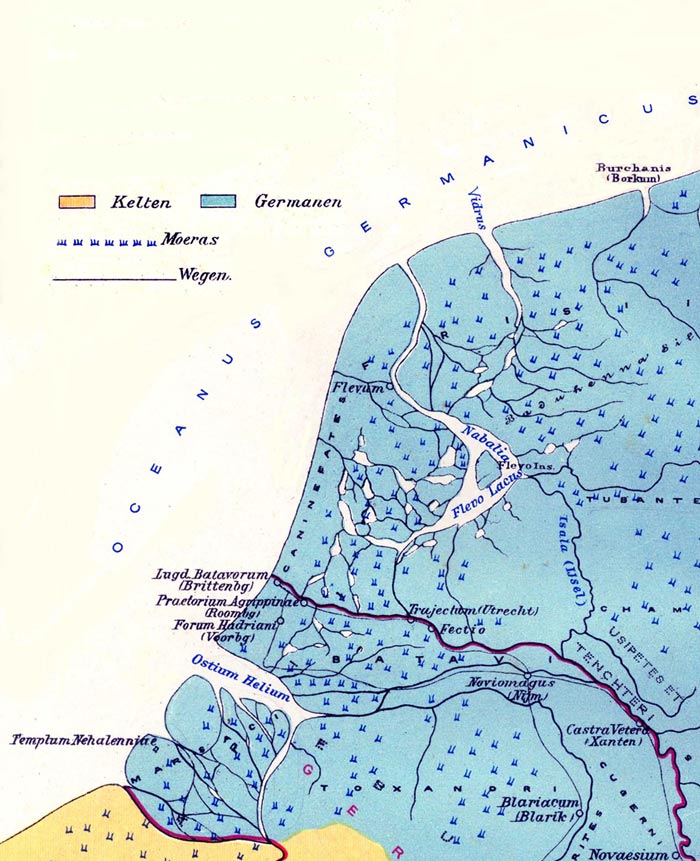
the Roman ageOnly places like Noviomagum (Nijmegen), Trajectum (Utrecht), Vectio (Vechten) and Lugdunum Batavorum (Brittenburg, now in sea near Katwijk) have been drawn at their proper loaction. It is not known how the interior and the coastal line looked in those days. In any case Flevum has been drawn in near Wieringen, where it ought to have been near Velsen bordering the IJ.
|