|
|
| |
 |
|
 Aerial phots from the second worldwar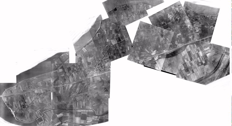 On October 5th and 29th, 1944, March 12th and 14th, 1945 allied reconnaissance airplanes flew over Wieringen to make pictures with which maps could be made for the imminent recapture of North-Holland from the Germans. A selection of 25 of these photos I have tried to piece together as good as possible. The endresult is an accurate picture of Wieringen before the re-allotments of the late 1940s would change the appearance of the landscape drastically. You can click on the photos to see a section in detail. As you will notice, pieces of the total picture are missing: Den Oever (strategically the most important because of the Afsluitdijk, perhaps that's why this part was not kept with the other photos) and parts of the lower lands below Hippolytushoef and the western part of the Polder Waard Nieuwland. Maybe these photos will find their way to this site some day... Aerial photos of: Hippolytushoef | Stroe and surroundings | Oosterland | Westerland | Westerklief
|