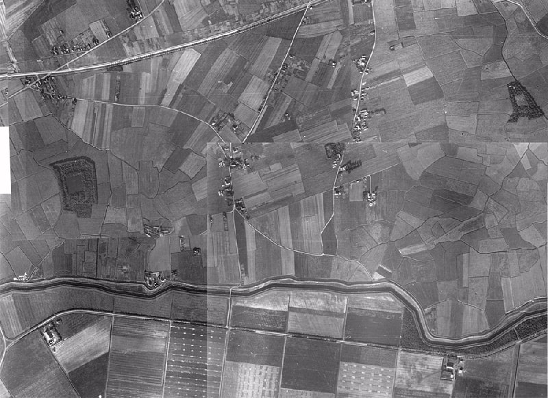
| On October 5th 1944 the pictures were taken I used to make this composite photo of Westerklief from. Unfortunately the pictures don't fit perfectly, what shows most at the Y-shaped crossing Westerklief - Hollebalgweg. Still this photo gives a fascinating view of the small scale agriculture that characterised the Wieringer landscape in those days. The difference with nearby Wieringermeer (the "wierdijk" (the dike made out of dried and pressed sea-weed) is a clear boundary. On one end the patchwork of small strips of land, called "krochtjes" in the local dialect, on the other side the new sterile conciseness of the Wieringermeer. |